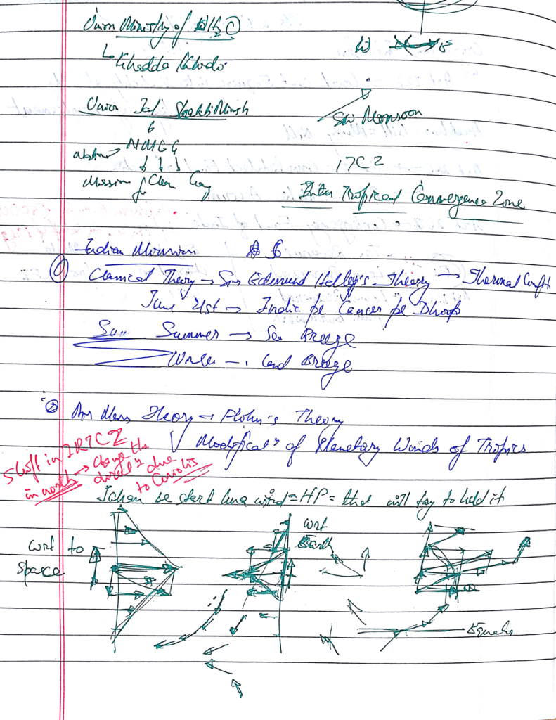
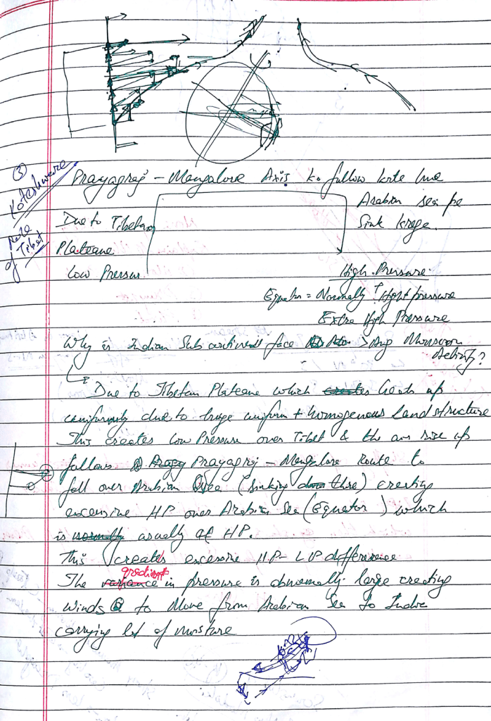
Indian monsoon
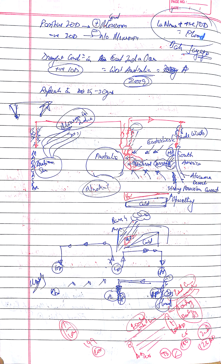
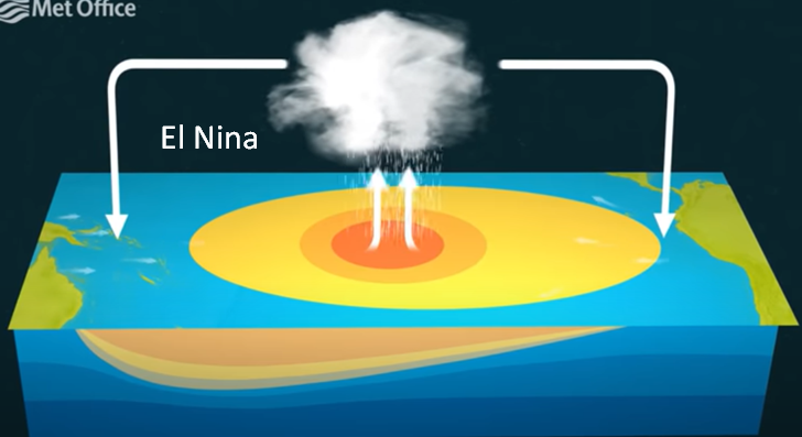
El Nino–
Eastward shifting of tropical storms.
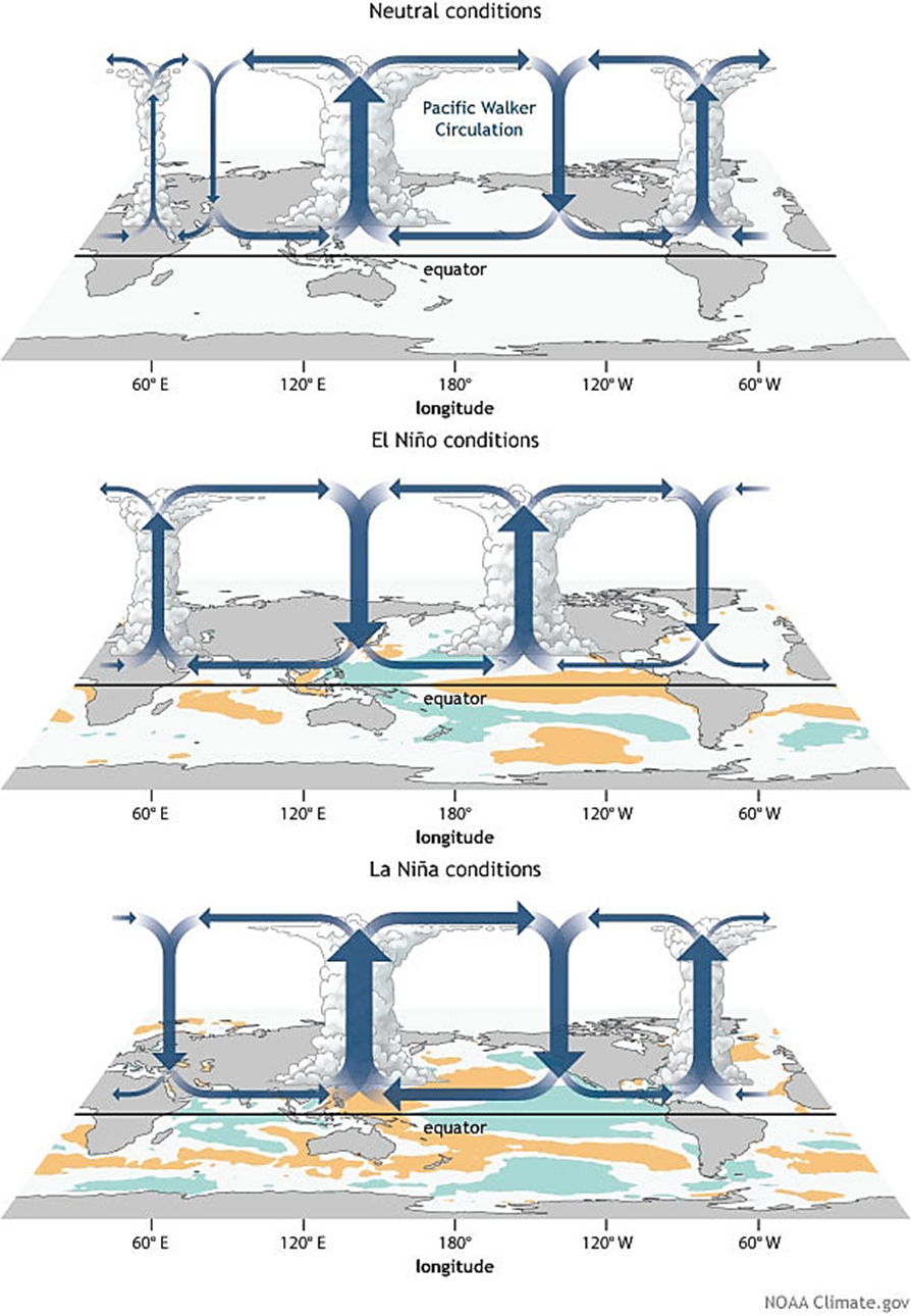
Weakening of prevailing easterly trade winds.
Occurrence of Pacific’s warmest surface waters offshore of northwestern South America
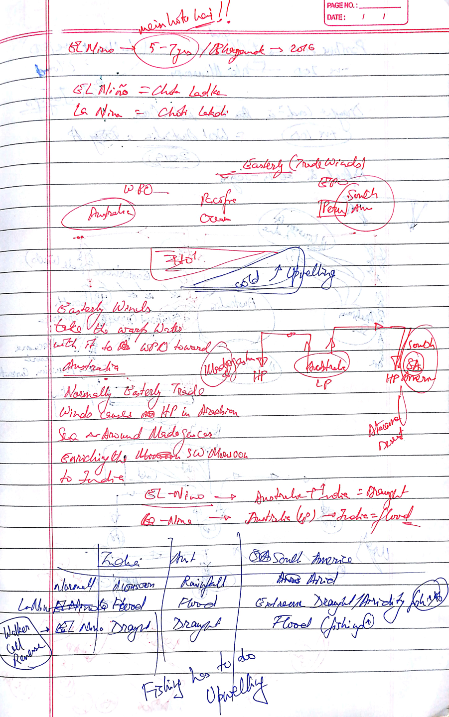
El Nino is an abnormal warming of water in the central and eastern tropical Pacific Ocean every 3-5 years and can last up to 18 months.
- Climate records of El Nino go back millions of years, with evidence of the cycle found in ice cores, deep sea muds, coral, caves and tree rings
World Meteorological Organization’s (WMO)–>2019= 2nd warmest year
2016= warmest year because of the combination of a very strong El Niño event, which has a warming impact, and long-term climate change.
The annual global temperature in 2019 was 1.1°C warmer than the average for 1850-1900, used to represent pre-industrial conditions.
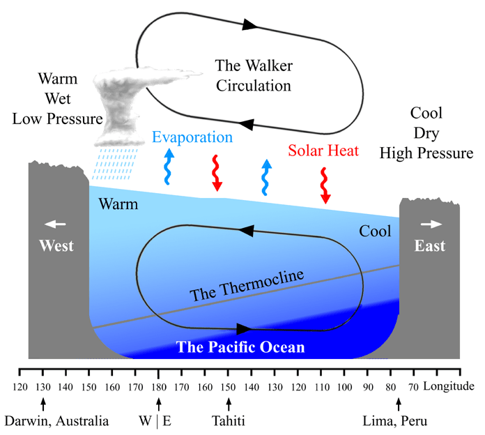
El Nino– Restricts the easterlies–>more rain in easter pacific+ less rainfall in west– peaks around Chrismas time + several month
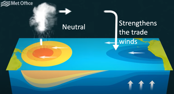
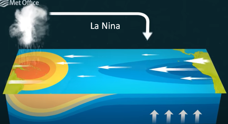
Generally winds blow east to west called Easterlies Trade winds in Equatorial Pacific ocean.–> blows the upper warm water surface to east–>
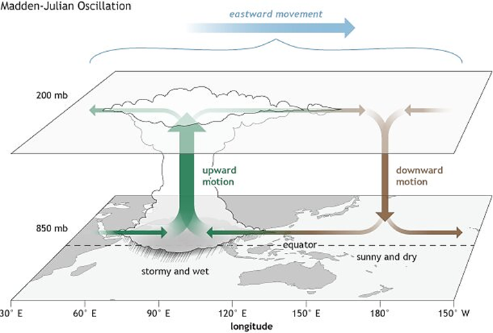
MJO- MADDEN–JULIAN OSCILLATION
What is?? —
The MJO can be defined as an eastward moving ‘pulse’ of clouds, rainfall, winds and pressure near the equator that typically recurs every 30 to 60 days.
•It’s a traversing phenomenon and is most prominent over the Indian and Pacific Oceans.
The Madden–Julian Oscillation (MJO), as it’s called, is a moving band of rain clouds that travels around the globe spanning 12,000–20,000 km across the tropical oceans.
Impacts & influences??
March 2019–> Heavy rains and floods in Indonesia due to Madden Julian oscillation (MJo)
In Aril 2019–> India was poised to receive below normal monsoon rainfall in April but ended up with excessive rain partly due to the MJO.
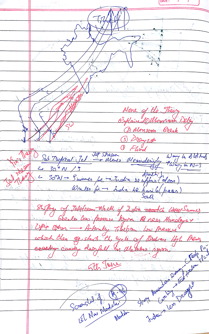
•Climate Prediction Centre of the US National Weather Service has said that unusually warm waters in the Arabian Sea have set up a rare band of easterly winds over the Indian Ocean, which has significantly delayed the monsoon onset over the Kerala coast.
•The number of factors has led to a dry spell in India, which is likely to continue throughout June
MJO: Its location and strength may play an important role in the development of monsoon over India during the next several weeks.
Cyclone ‘Vayu’: It took advantage of an MJO wave traversing the West Indian Ocean and adjoining South Arabian Sea. Storm initiation: Over the East Indian Ocean and adjoining Bay of Bengal have led to oceanic circulation over North-East and adjoining East-Central Bay.
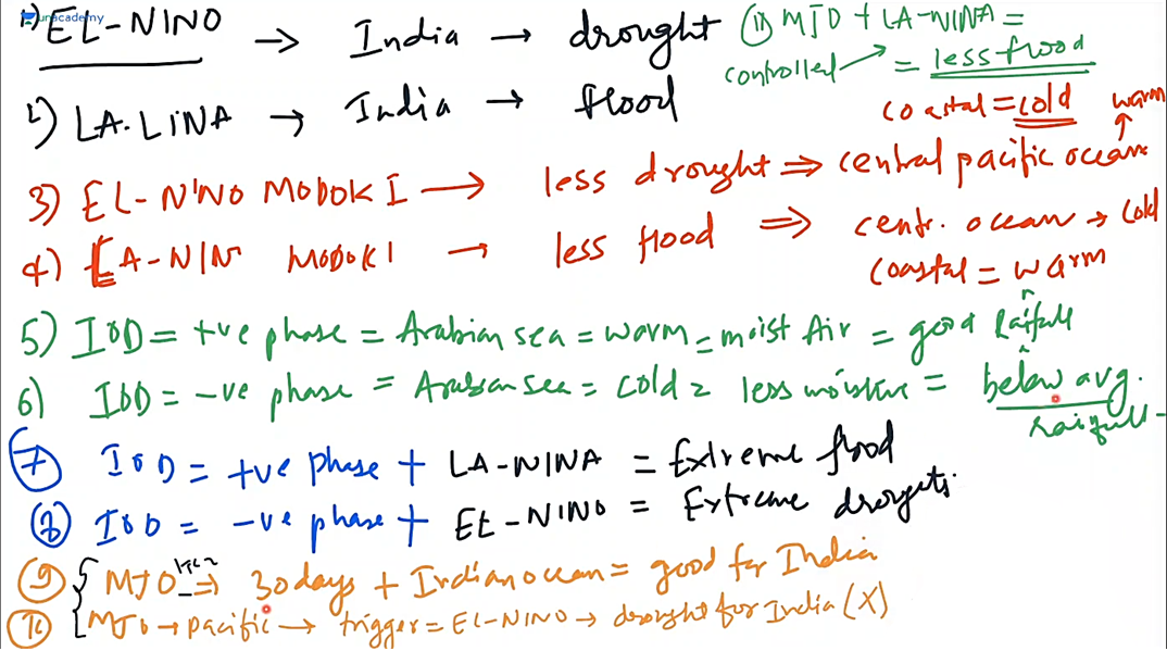
The MJO has wide ranging impacts on the patterns of tropical and extratropical precipitation, atmospheric circulation, and surface temperature around the global tropics and subtropics. There is evidence that the MJO influences the ENSO cycle. It does not cause El Niño or La Niña, but can contribute to the speed of development and intensity of El Niño and La Niña episodes.
Phases
A wet phase of improved convection (rainfall) is trailed by a dry phase, where rainstorm
movement is suppressed(no precipitation). Each cycle lasts around 30-60 days and there are 8 phases
Eight phases/stages of MJO are:
•Stage 1 – Enhanced convection (precipitation) creates over the western Indian Ocean.
•Stage 2 and 3 – Enhanced convection (precipitation) moves gradually eastwards over
Africa, the Indian Ocean and parts of the Indian subcontinent.
•Stage 4 and 5 – Enhanced convection (precipitation) has achieved the Maritime
Continent (Indonesia and West Pacific)
•Stage 6, 7 and 8 – Enhanced precipitation moves further eastward over the western
Pacific, in the long run vanishing in the focal Pacific.
•The next MJO cycle begins.
How Does MJO Affect Indian Monsoon?
- The Indian Ocean Dipole (IOD), El Nino and MJO are all oceanic and atmospheric phenomena, which affect weather on a large scale. IOD only pertains to the Indian Ocean, but the other two affect weather on a global scale-up to the mid-latitudes.
- IOD and El Nino remain over their respective positions, while MJO is a traversing phenomenon.
- The journey of MJO goes through eight phases.
- When it is over the Indian Ocean during the Monsoon season, it brings good rainfall over the Indian subcontinent.
- On the other hand, when it witnesses a longer cycle and stays over the Pacific Ocean, MJO brings bad news for the Indian Monsoon.
- It is linked with enhanced and suppressed rainfall activity in the tropics and is very important for the Indian monsoonal rainfall.
- Periodicity of MJO:
- If it is nearly 30 days then it brings good rainfall during the Monsoon season.
- If it is above 40 days then MJO doesn’t give good showers and could even lead to a dry Monsoon.
- Shorter the cycle of MJO, better the Indian Monsoon. Simply because it then visits the Indian Ocean more often during the four-month-long period.
- Presence of MJO over the Pacific Ocean along with an El Nino is detrimental for Monsoon rains.
