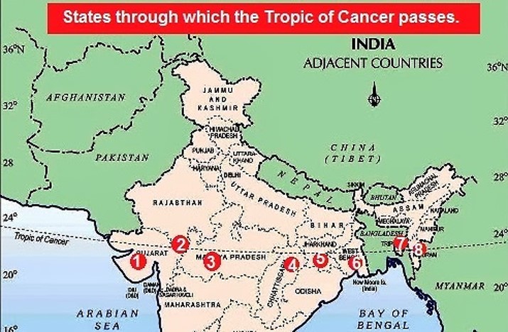
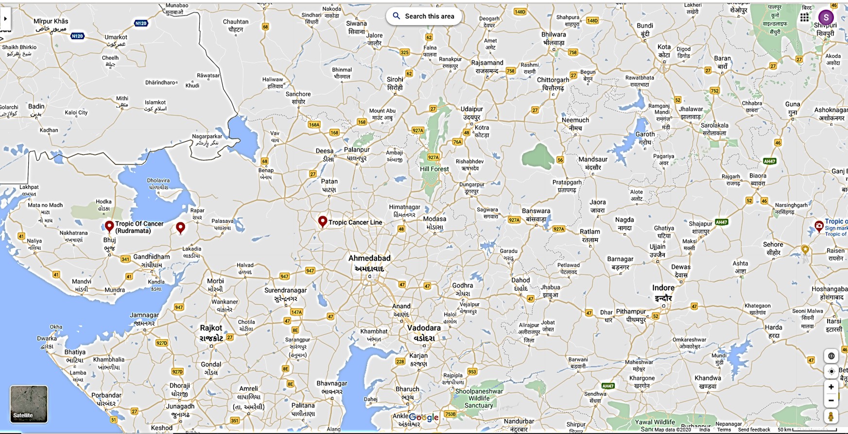
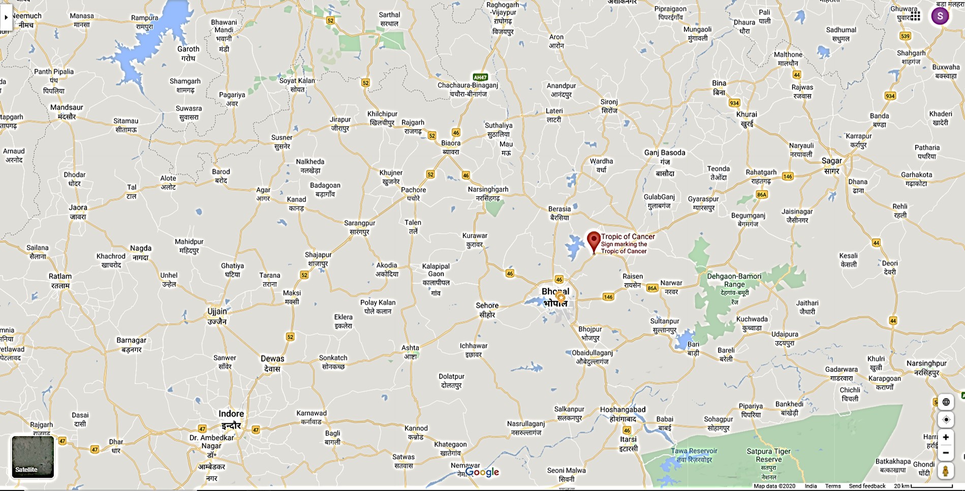
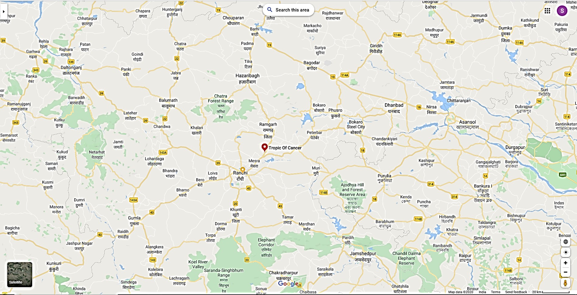
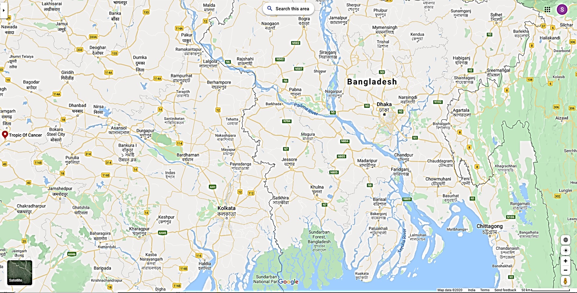
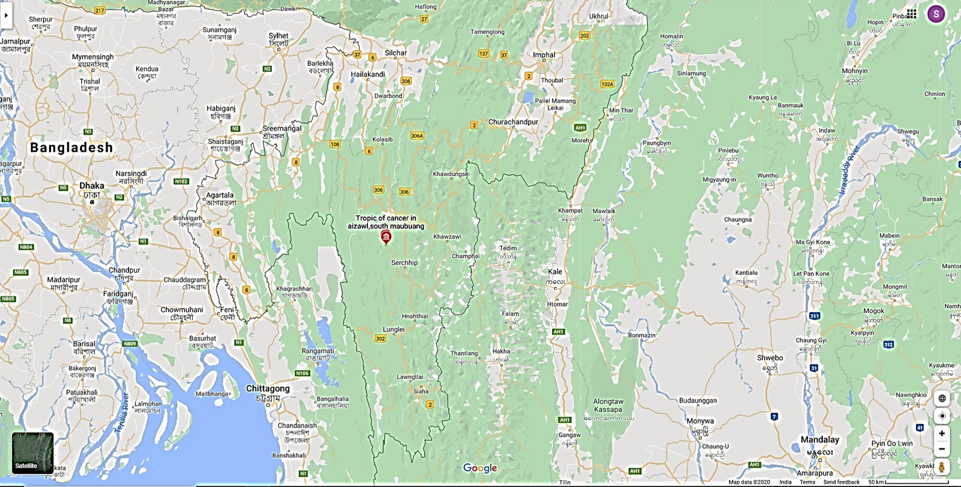
Tropic of Cancer passing through India
India has
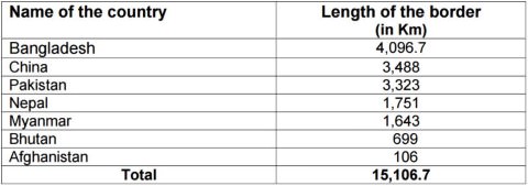
15106.7 Km = land border running through 92 districts in 17 States.
7516.6 Km = Coastline
[6100 km of mainland coastline + coastline of 1197 Indian islands]
touching 13 States and Union Territories (UTs).
Bangladesh, China, Pakistan, Nepal, Myanmar, Bhutan and Afghanistan
(Ban Chinese Phone. No Man will Buy Any.)
Pakistan: Jammu and Kashmir, Punjab, Rajasthan and Gujarat
(Padhne Ja PaR Ghar mat bhulna)
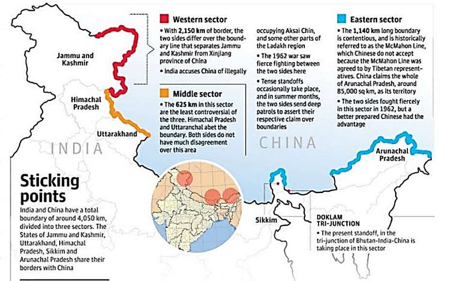
Bordering China: Jammu and Kashmir, Himachal Pradesh, Uttarakhand, Sikkim and Arunachal Pradesh
(SUJA Hua Chin)
Bordering Nepal: Bihar, Uttarakhand, Uttar Pradesh, Sikkim and West Bengal
(BUUS ab Nake par Wait nahi karegi)
Bordering Bangladesh (4096km): West Bengal, Mizoram, Meghalaya, Tripura and Assam.
(People are getting sick in Waiting lines so More ATMs are BANNED)
Bordering Bhutan: West Bengal, Sikkim, Arunachal Pradesh and Assam
(Bhuchal aaya AWAS fir se banane padenge)
Bordering Myanmar (1643km): Arunachal Pradesh, Nagaland, Manipur and Mizoram.
(Aruna ke Man ki Maina Mauz mein Naach rahi hai)
Bordering Afghanistan (80km): Jammu and Kashmir (POK)
http://strategicstudyindia.blogspot.com/2017/07/army-pla-in-tug-of-war-over-doklam.html
The Western Sector
- Separates Jammu and Kashmir state of India from the Sinkiang (Xinjiang) province of China.
- The western sector boundary is largely the outcome of the British policy towards the state of Jammu and Kashmir.
- China claims the
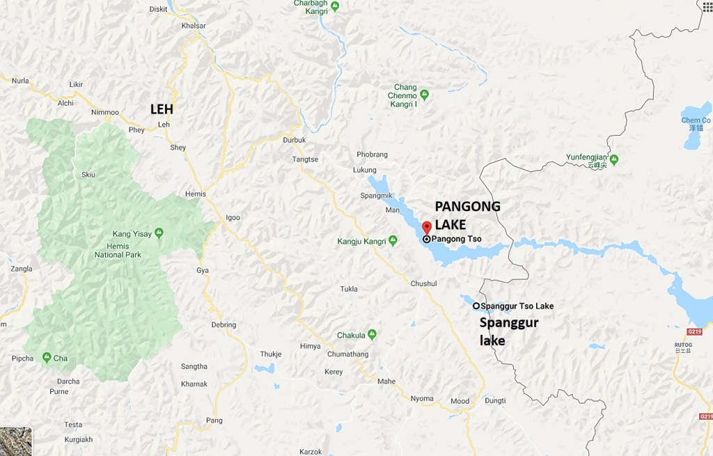
Aksai Chin district,
the Changmo valley,
Pangong Tso and
the Sponggar Tso
area of north-east Ladakh as well as a strip of about 5,000 sq km down the entire length of eastern Ladakh. - China also claims a part of Huza-Gilgit area in North Kashmir (ceded to it in 1963 by Pakistan).
The Middle Sector
- Two Indian states of Himachal Pradesh and Uttarakhand touch this border.
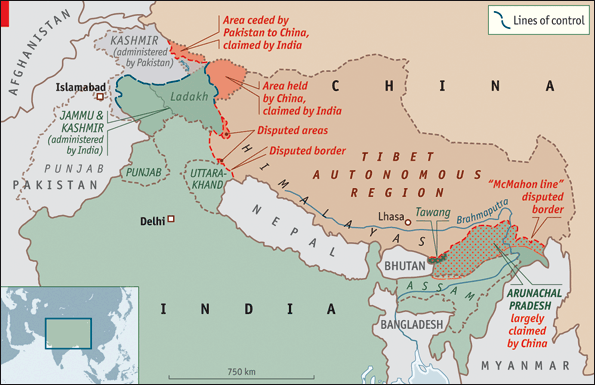
The Eastern Sector
- The 1,140 km long boundary between India and China runs from the eastern limit of Bhutan to a point near Diphu pass (Talu Pass) at the trijunction of India, Tibet and Myanmar.
- This line is usually referred to as the Mc Mahon Line after Sir Henry Mc Mahon, then foreign secretary of British India, who negotiated the boundary agreement between Great Britain and Tibet at Shimla accord in 1913-14.
Durand Line is the line demarcating the boundaries of India and Afghanistan. It was drawn up in 1896 by Sir Mortimer Durand.
Macmahon Line was drawn up by Sir Henry MacMahon, demarcating the frontier of India,Sikkim and China in 1914. China did not recognize the MacMahon line and crossed it in 1962 (Indo-China war.. took Aksai Chin)
Radcliffe Line was drawn up by Sir Cyril Radcliffe, demarcating the boundary between India and Pakistan.
LOC = LINE OF CONTROL IS THE IMAGINARY LINE SEPARATING INDIA & PAKISTAN THIS LINE IS NOT LEGALLY RECOGNIZED BY INTERNATIONAL COMMUNITY BUT ONLY BY BOTH INDIA & PAKISTAN .
IF ANYONE , INDIA OR PAKISTAN CROSSED THE LOC OTHER THAN FOR HUMANITARIAN PURPOSE IT WILL INCITE MILITARY ACTION FROM BOTH SIDES.
LAC = LINE OF ACTUAL CONTROL IS THE IMAGINARY LINE SEPARATING INDIA & CHINA AT BOTH AKSAI CHIN & NEAR ARUNACHAL PRADESH.
BUT IN LAC IT IS AGREED BY BOTH INDIA & CHINA IN THE 1996 SINO-INDIAN AGREEMENT THAT BOTH SIDES WILL NOT DO ANY ACTS OF SOVEREIGN WHICH WILL OVERSTEP THIS IMAGINARY LINE.
SO IN SHORT……
IN LOC THERE IS A LOT OF CHANCE FOR ARMED CONFLICT BUT IN LAC THE CHANCES FOR ARMED CONFLICT IS RELATIVELY VERY LOW BUT STILL THE THREAT EXISTS ON BOTH SIDES ON BOTH LOC & LAC.
Important Lines and Boundaries
Durand Line is the line demarcating the boundaries of India and Afghanistan. It was drawn up in 1896 by Sir Mortimer Durand.
Hindenburg Line is the boundary dividing Germany and Poland. The Germans retreated to this line in 1917 during World War I.
Mason-dixon Line is a line of demarcation between four states in the United States.
Marginal Line was the 320 km line of fortification built by France along its border with Germany before World War II, to protect its boundary from German attack.
Mannerheim Line is the line of fortification on the Russia-Finland border. Drawn up by General Mannerheim.
Macmahon Line was drawn up by Sir Henry MacMahon, demarcating the frontier of India and China. China did not recognize the MacMahon line and crossed it in 1962.
Medicine Line is the border between Canada and the United States.
Order-neisse Line is the border between Poland and Germany, running along the Order and Beisse rivers, adopted at the poland Conference (August 1945) after World War II.
Radcliffe Line was drawn up by Sir Cyril Radcliffe, demarcating the boundary between India and Pakistan.
Siegfried Line is the line of fortification drawn up by Germany on its border with France.
17th Parallel defined the boundary between North Vietnam and South Vietnam before the two were united.
24th Parallel is the line which Pakistan claims for demarcation between India and Pakistan. This, however, is not recognized by India.
26th Parallel south is a circle of latitude which croses through Africa, Australia and South America.
30th Parallel north is a line of latitude that stands one-third of the way between the equator and the North Pole.
33rd Parallel north is a circle of latitude which cuts through the southeren United States, parts of North Africa, parts of the Middle East, and China.
35th Parallel north forms the boundary between the State of North Carolina and the State of Georgia and the boundary between the State of Tennessee arid the State of Georgia the State of Alabama, and the State of Mississippi.
36°30’ Parallel north forms the boundary between the Tennessee and Commonwealth of Kentucky between the Tennessee River and the Mississippi River, the boundary between Missiouri and Arkansas west of the White River, and the northernmost boundary between the Texas and the Oklahoma.
37th Parallel north formed the southern boundary of the historic and extralegal Territory of Jefferson.
38th Parallel is the parallel of latitude which separates North Korea and South Korea.
39th Parallel north is an imaginary circle of latitude that is 39 degrees north of the Earth’s equatorial plane.
40th Parallel north formed the original northern boundary of the British Colony of Maryland.
41th Parallel north forms the northern boundary of the State of Colorado with Nebraska and Wyoming and the southern boundary of the State of Wyoming with Colorado and Utah.
42nd Parallel north forms most of the New York – Pennsylania Border.
43rd Parallel north forms most of the boundary between the State of Nebraska and the State of South Dakota and also formed the northern border of the historic and extralegal Territory of Jefferson.
The Parallel 44° north is an imaginary circle of latitude that is 44 degrees north of the Earth’s equatorial plane.
45th Parallel north is often called the halfway point between the Equator and the North Pole. The 45th parallel makes up most of the boundary between Montana and Wyoming. 45th parallel of south latitude is the east-west line that marks the theoretical halfway point between the equator and the South Pole.
49th Parallel is the boundary between USA and Canada.
